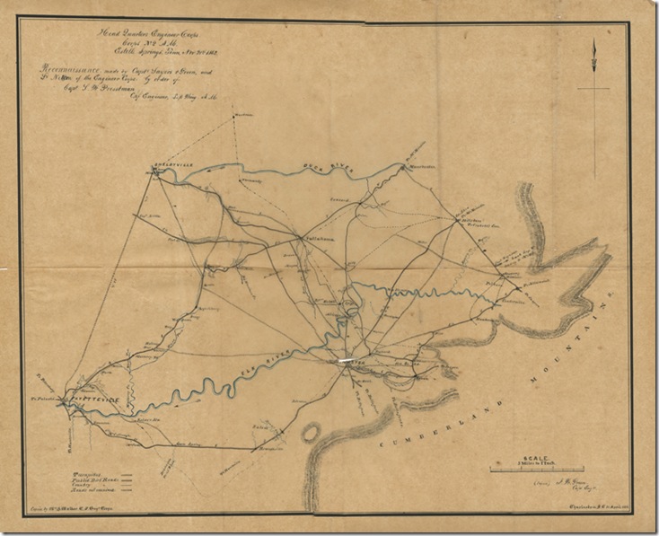
This map of the area around Estill Springs, Tennessee, made from the reconnaissance of Captains Sayers & Green and Liuetenant Nelson of the Engineer Corps one of twenty-four military maps and drawings in a collection of papers from Confederate General P.G.T. Beauregard. The map notes that the reconnaissance was carried out November 21, 1862 and this copy of the map was created on April 28, 1863.
Citation: Reconnaissance made by Capts Sayers & Green and Lt. Nelson of the Engineer Corps. Estelle [i.e. Estill] Springs, Tenn. 21 November 1862.Copied by William A Walker. Charleston S.C., 28 April 1863. AMs 1168/11

.…
good….
.…
áëàãîäàðþ….
.…
hello!…
.…
ñýíêñ çà èíôó!…
.…
thank you….